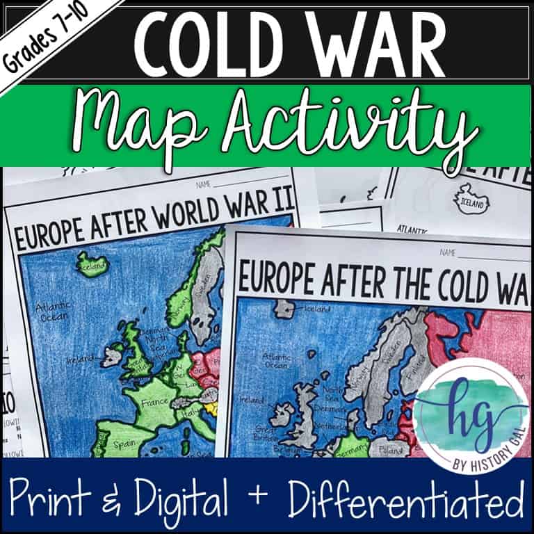


Description
Teaching the Cold War? Incorporate maps to help your students understand how the Cold War impacted the map of Europe. These two no-prep print and digital map sets make it easy for your students to practice their mapping and geography skills as they create maps they can use throughout your Cold War units.
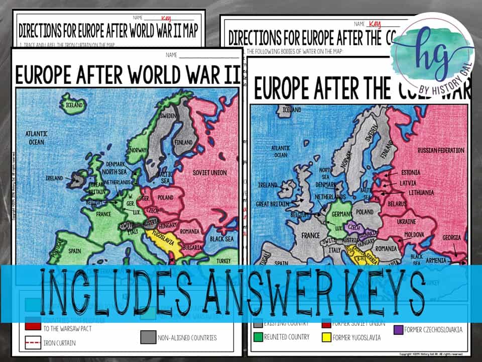
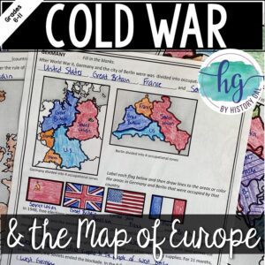
This download includes TWO map sets! This first map focuses on Europe after World War II at the start of the Cold War. Students will identify nations that belonged to NATO, the Warsaw Pact, and which ones remained neutral. The second map examines Europe in 1991 after the collapse of the Soviet Unit.
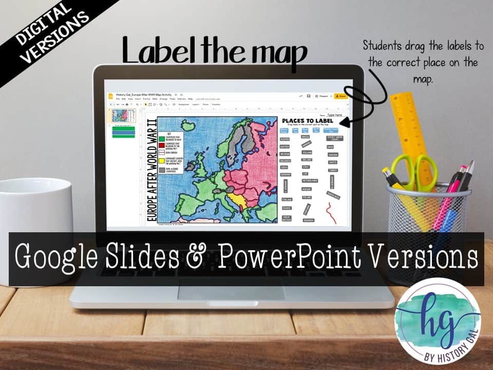
To complete each map, students will follow a PowerPoint or Google Slides presentation step by step to label and color the maps. Have a paperless classroom? Digital versions are included! Students can also label the maps by dragging and dropping labels on a digital PowerPoint or Google Slides map.
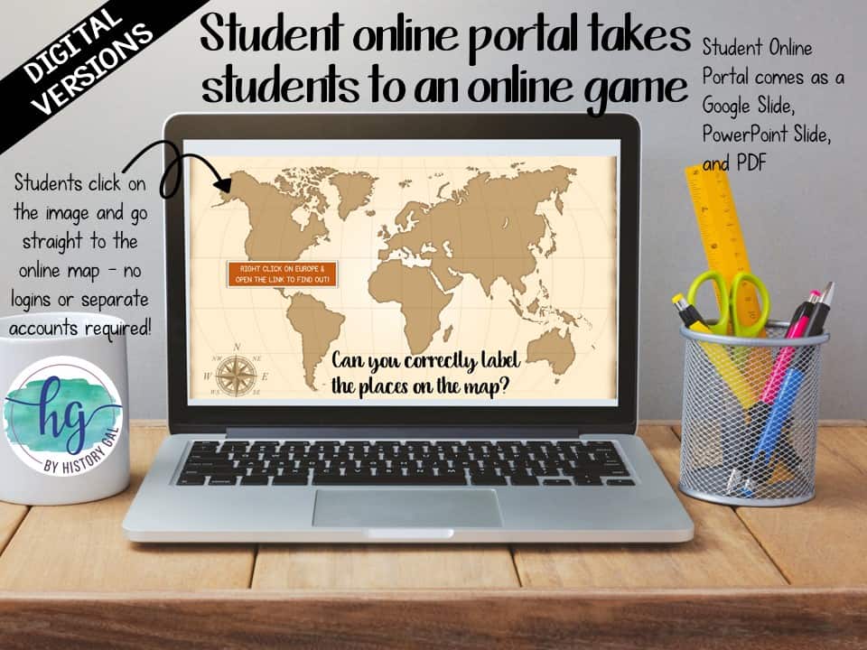
Lastly, students can practice what they’ve learned by using self-checking online maps!
What’s included:
✅ Print & Digital Map Versions for TWO maps (Europe After WWII & Europe in 1991)
✅ Differentiated Options
✅ PowerPoint & Google Slides Decks
✅ Links to Self-Checking Online Map
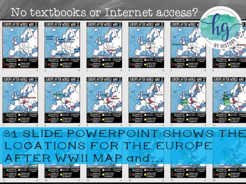
Europe After World War II:
Students will label:
Bodies of Water: Atlantic Ocean, Mediterranean Sea, Black Sea, North Sea, Baltic Sea
Countries: Albania, Austria, Belgium, Bulgaria, Czechoslovakia, Denmark, East Germany, Finland, France, Great Britain, Greece, Hungary, Iceland, Ireland, Italy, Luxembourg, Netherlands, Norway, Poland, Portugal, Romania, Soviet Union, Spain, Sweden, Switzerland, Turkey, West Germany, Yugoslavia
Iron Curtain
Alliances: countries that belonged to NATO, countries that belonged to the Warsaw Pact, the Communist country that did not belong to the Warsaw Pact, non-aligned countries
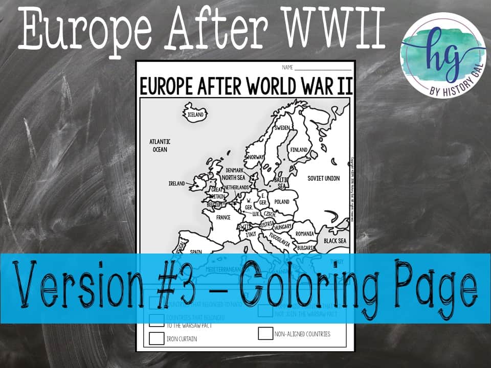
Too much for some of your students to label or need to cover it quicker? Use the included coloring page version!
What’s Included with the Print Version:
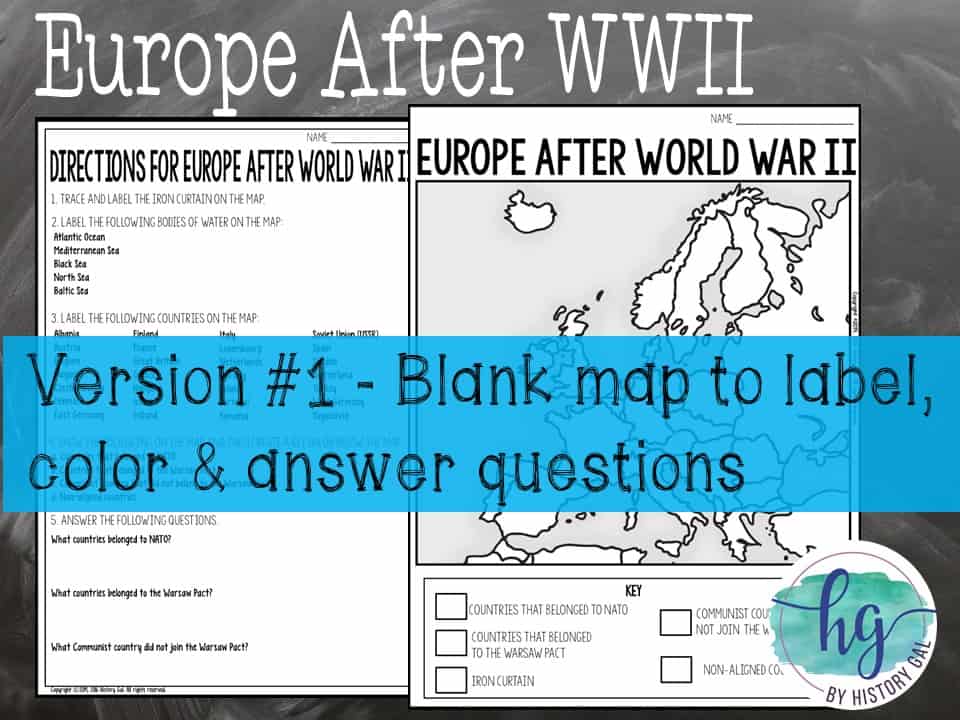
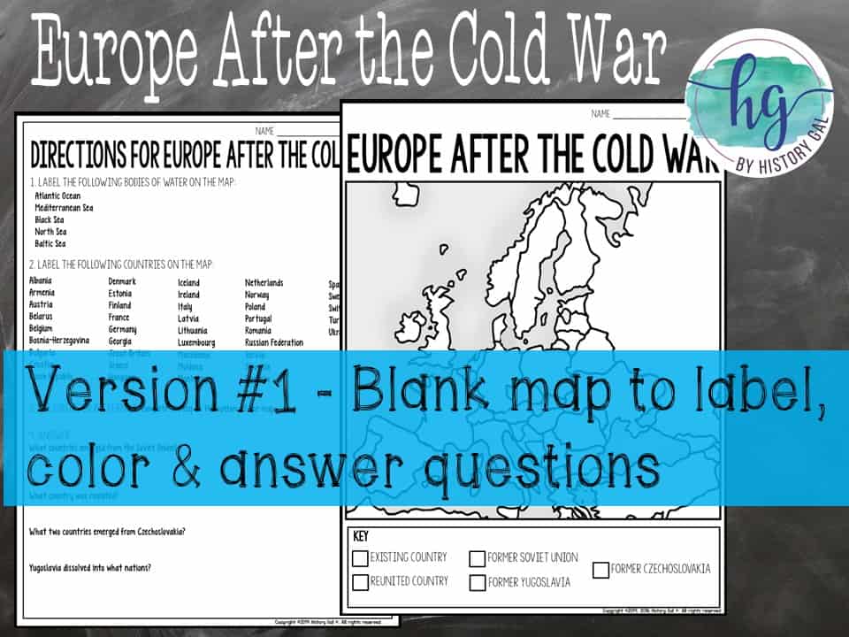
⭐️Blank Europe After World War II map with questions for students to answer (2 pages)
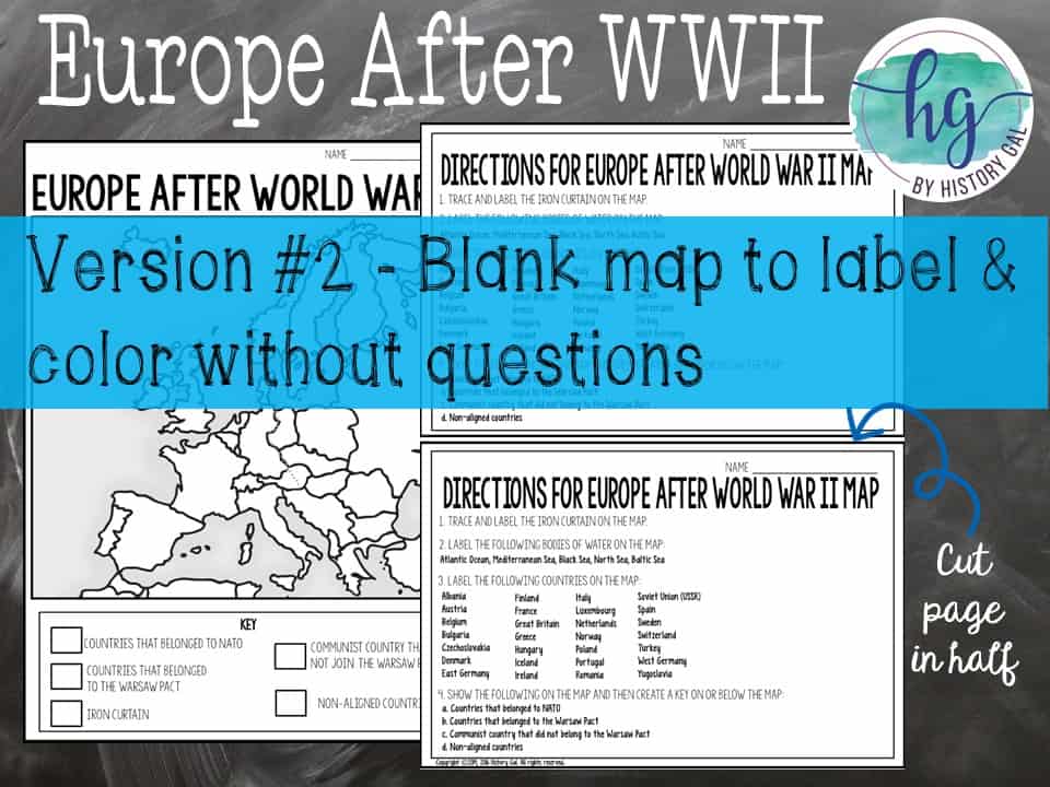
⭐️Blank Europe After World War II map without questions (1 1/2 pages)
⭐️Coloring Page for Europe After World War II (1 page)
⭐️Answer key for Europe After World War 2 map (2 pages)
⭐️Animated PowerPoint guides students step-by-step through completing the map (31 slides, some text is editable but images are not)
What’s included with the Digital Version:
⭐️ Map for students to label (students will drag labels to the correct spot on the already colored map and complete the key; PowerPoint & Google Slides versions; not editable)
⭐️ Google Slides deck guides students step-by-step through completing the map (31 slides, some text is editable but images are not)
⭐️ Answer key for map (1 page, uneditable pdf,)
⭐️ Self-checking Online Map lets students test their knowledge of locations (internet connection is required to access, works on all browsers and with all devices, no account and no logins required)
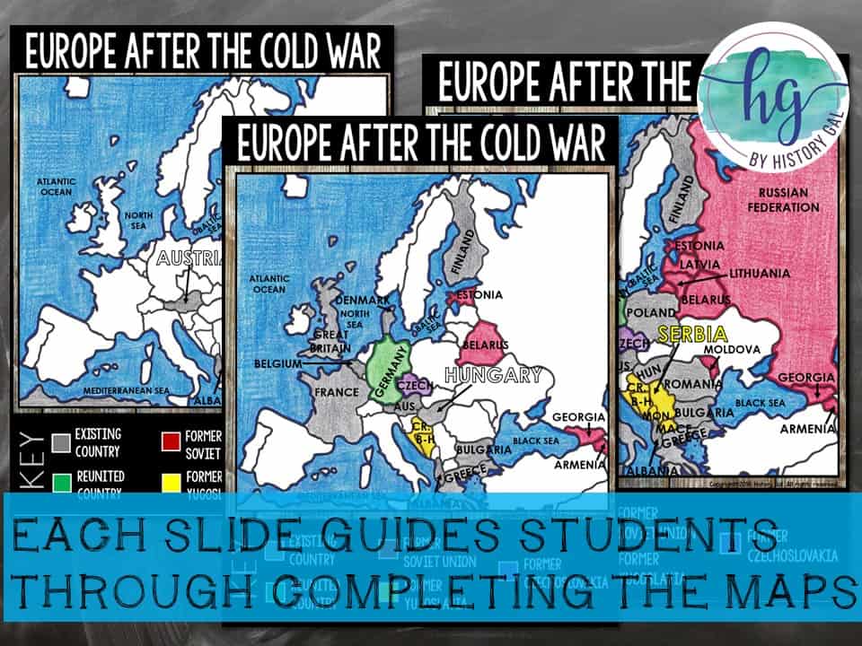
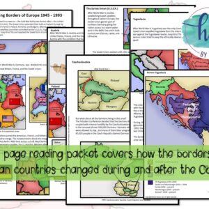
Europe After the Cold War (Europe in 1991):
Students will label:
Bodies of Water: Atlantic Ocean, Mediterranean Sea, Black Sea, North Sea, Baltic Sea
Countries: Albania, Armenia, Austria, Belarus, Belgium, Bosnia-Herzegovina, Bulgaria, Croatia, Czech Republic, Denmark, Estonia, Finland, France, Germany, Georgia, Great Britain, Greece, Hungary, Iceland, Ireland, Italy, Latvia, Lithuania, Luxembourg, Macedonia, Moldova, Montenegro, Netherlands, Norway, Poland, Portugal, Romania, Russian Federation, Serbia, Slovakia, Slovenia, Netherlands, Norway, Poland, Portugal, Romania, Russian Federation, Serbia, Slovakia, Slovenia
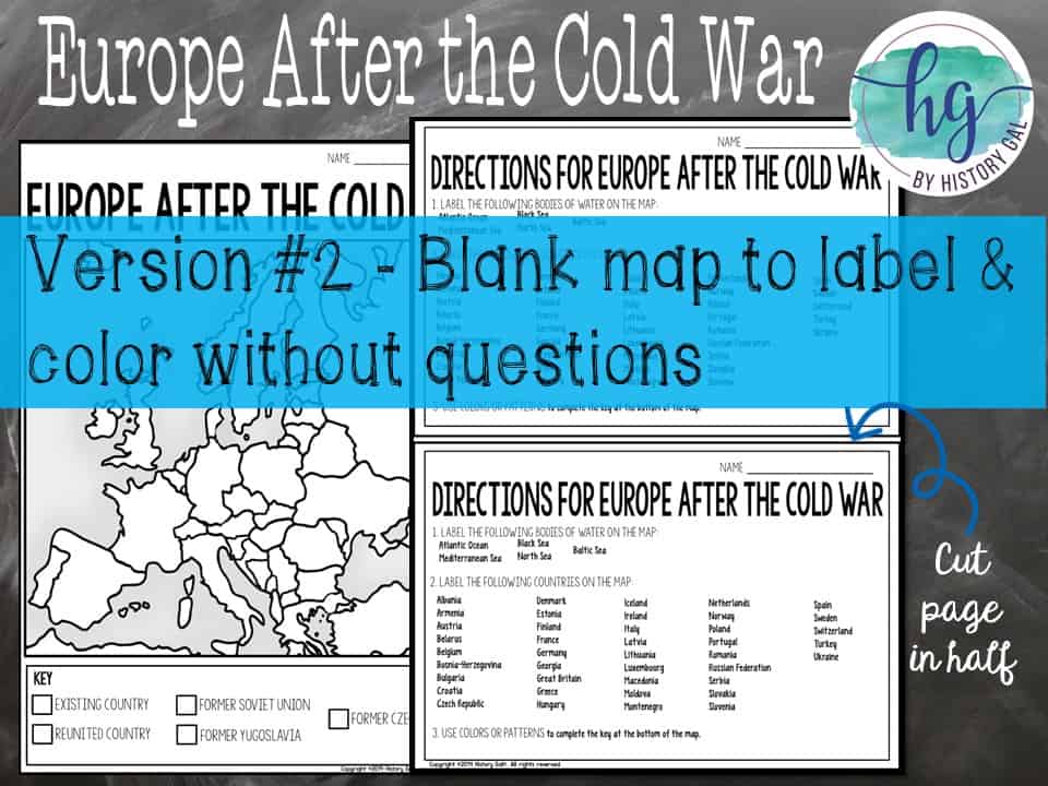
Map Changes: existing country, reunited country, former Soviet Union, former Yugoslavia, former Czechoslovakia
Too much for some of your students to label or need to cover it quicker? Use the included coloring page version!
What’s Included with the Print Version:
⭐️Blank Europe After the Cold War map with questions for students to answer (2 pages)
⭐️Blank Europe After the Cold War map without questions for students to answer (1 1/2 pages)
⭐️Coloring Page for Europe After the Cold War (1 page)
Answer key for Europe After the Cold War (2 pages)
⭐️Animated PowerPoint guides students step-by-step through completing the map (43 slides, some text is editable but images are not)
What’s included with the Digital Version:
⭐️ Map for students to label (students will drag labels to the correct spot on the already colored map and complete the key; PowerPoint & Google Slides versions; not editable)
⭐️ Google Slides deck guides students step-by-step through completing the map (43 slides, some text is editable but images are not)
⭐️ Answer key for map (1 page, uneditable pdf,)
⭐️ Self-checking Online Map lets students test their knowledge of locations (internet connection is required to access, works on all browsers and with all devices, no account and no logins required)
***This is included in the following larger unit bundles:
* U.S. History from 1877 Map Activities Bundle
* U.S. History Map Activities Bundle
* U.S. History to 1877 Bundle
* U.S. History 1877 to Present Bundle
* U.S. History Mega Bundle: Exploration to Present
Questions? Check out the FAQs.
Copyright © History Gal. All rights reserved by author.
Personal classroom use only.


&url=https://byhistorygal.com/product/cold-war-map-activity-print-and-digital/&media=https://byhistorygal.com/wp-content/uploads/2022/02/History-Gal_Cover-Cold-War-Map-Activity-1.jpg)
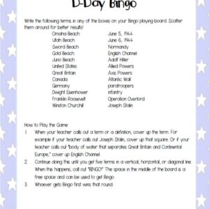
%20D-Day%20Bingo%20Freebie!&url=https://byhistorygal.com/product/world-war-ii-wwii-d-day-bingo-freebie/&media=https://byhistorygal.com/wp-content/uploads/2020/02/History-Gal_Cover-D-Day-Bingo-1.jpg)
Reviews
There are no reviews yet.