


Description
These World War II in Europe and World War 2 in the Pacific maps will help students become more familiar with the nations of Europe and those in the Pacific during World War II by identifying which countries belonged to the Allies, which ones joined the Axis, which ones were controlled by the Axis Powers, and which ones remained neutral. Students will also label important battles in the European and Pacific theaters.
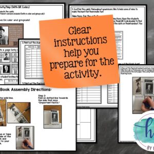
This download is full of options from differentiated maps versions, step-by-step PowerPoint & Google Slides decks that students use to complete their maps as well as print & digital options. There are even self-checking online maps that students can use! It’s packed full of resources to help you meet the needs of all of your students.
✅ Print & Digital Map Versions for WWII in Europe & in the Pacific
✅ Differentiated Options for WWII in Europe & in the Pacific
✅ PowerPoint & Google Slides Decks for WWII in Europe & in the Pacific
✅ Link to Self-Checking Online Map for WWII in Europe & in the Pacific
Students will label the following on the maps:
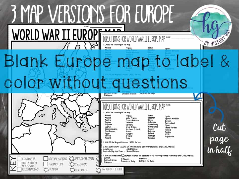
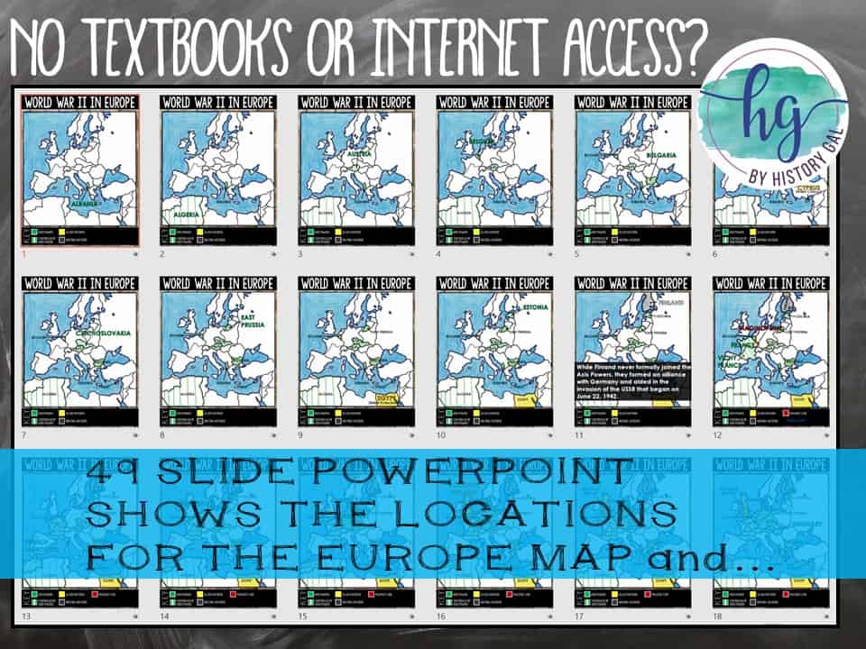
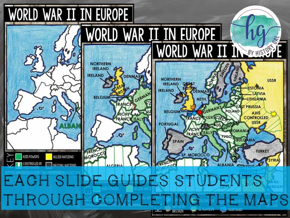
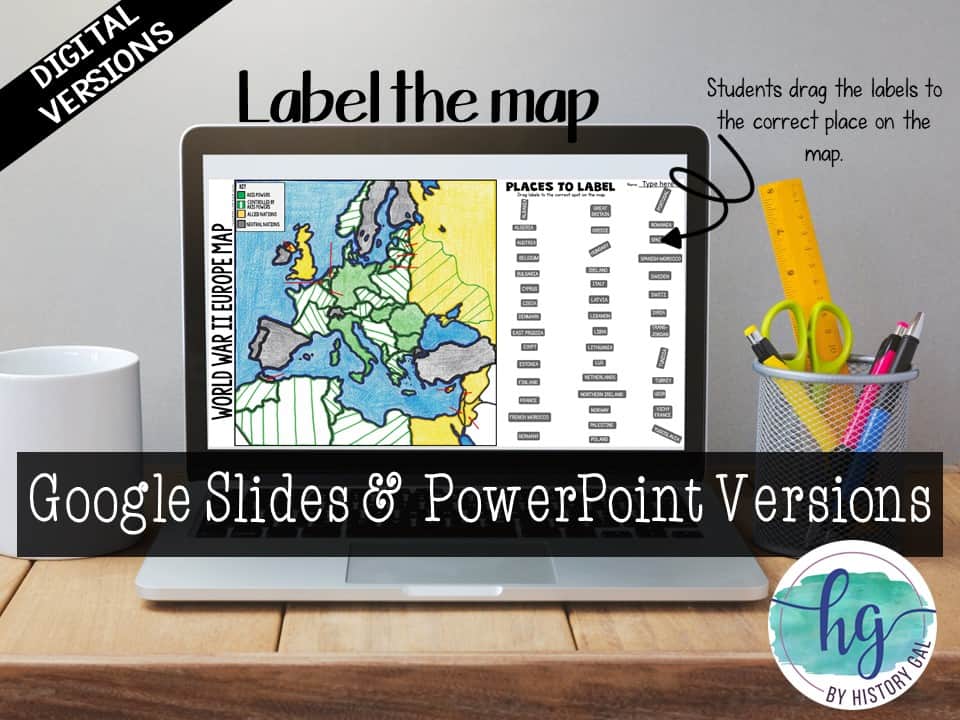
World War II in Europe Map: Allied, Axis, and Neutral countries, countries controlled by Axis powers, the Maginot Line, the Battle of Dunkirk, the Battle of Britain, the Battle of Stalingrad, the Battle of El Alamein, the Invasion of Sicily, the Invasion of Normandy, and the Battle of the Bulge
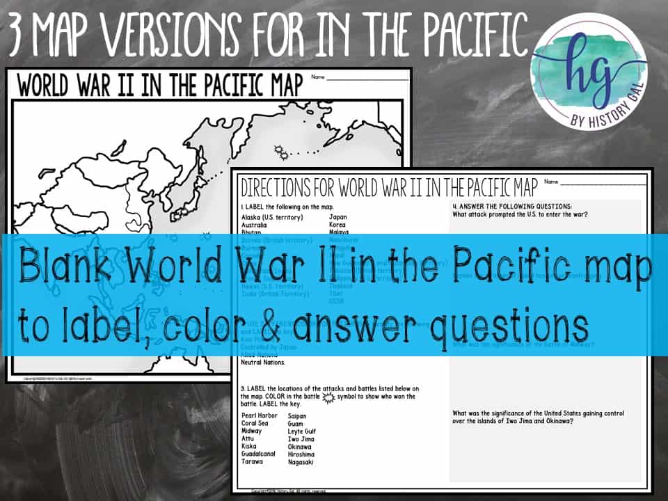
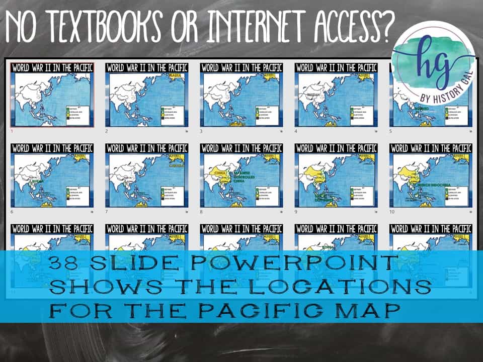
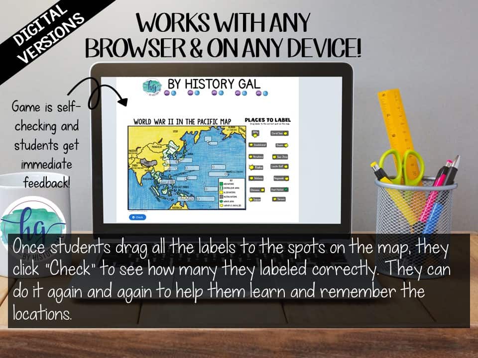
World War II in the Pacific Map: Allied, Axis, and Neutral countries, countries controlled by Japan, the Attack on Pearl Harbor, the Battle of Coral Sea, the Battle of Midway, the Battle of Attu, the Battle of Kiska, the Battle of Guadalcanal, the Battle of Tarawa, the Battle of Saipan, the Battle of Guam, the Battle of Leyte Gulf, the Battle of Iwo Jima, the Battle of Okinawa, and the bombings of Hiroshima and Nagasaki.
What’s Included with the Printed Versions:
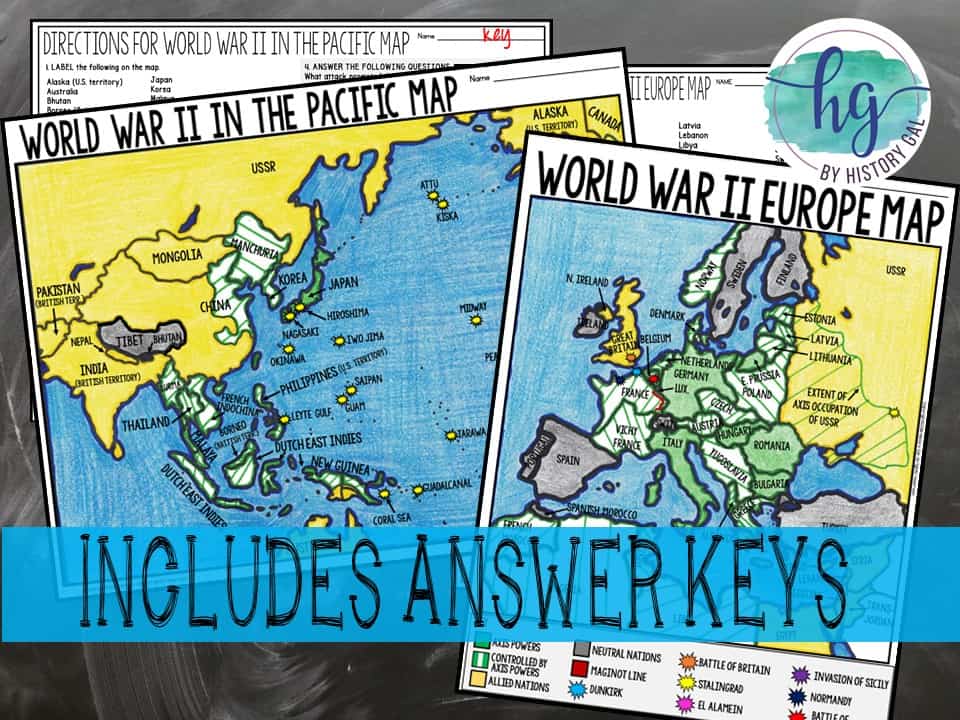
⭐️Blank World War II in Europe map with questions for students to answer (2 pages, uneditable pdf)
⭐️Blank World War II in Europe map without questions (1 1/2 pages, uneditable pdf)
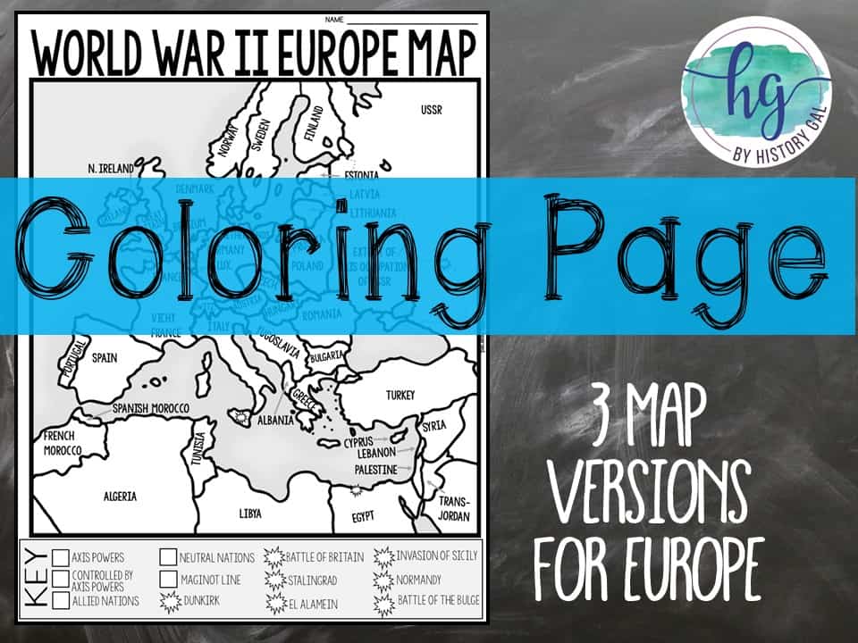
⭐️Coloring Page for World War II in Europe map (1 page, uneditable pdf)
⭐️Answer key for World War 2 in Europe map (2 pages, uneditable pdf)
⭐️Animated PowerPoint shows each location and the key – perfect for classrooms without textbooks or Internet access (49 slides, each slide guides students through completing the map, some text is editable but images are not)
⭐️Blank World War II in the Pacific map with questions for students to answer (2 pages, uneditable pdf)
⭐️Blank World War 2 in the Pacific map without questions for students to answer (1 1/2 pages, uneditable pdf)
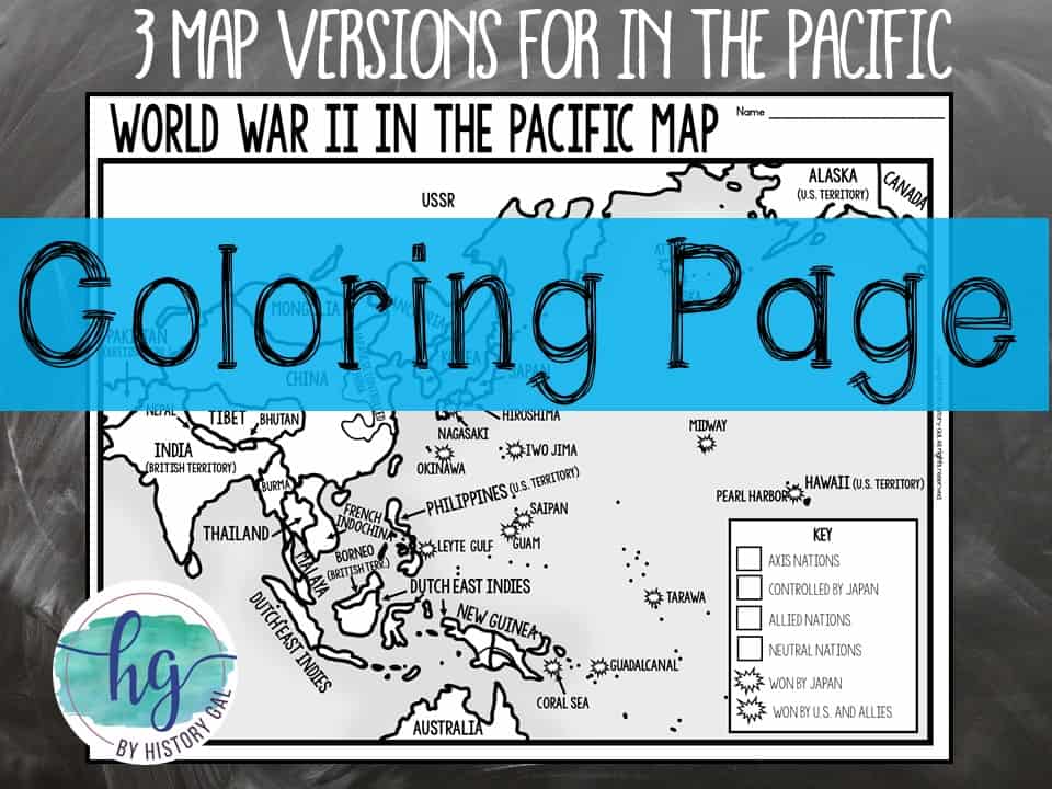
⭐️Coloring Page for World War II in the Pacific (1 page, uneditable pdf)
⭐️Answer key for World War II in the Pacific map (2 pages, uneditable pdf)
⭐️Animated PowerPoint shows each location and the key – perfect for classrooms without textbooks or Internet access 38 slides, each slide guides students through completing the map, some text is editable but images are not)
What’s included with the Digital Versions:
⭐️World War II in Europe and WW II in Pacific for students to label (Slides 1 & 2 students will drag labels to the correct spot on the map; Optional Slide 3 includes questions for students to answer; PowerPoint & Google Slides versions; not editable)
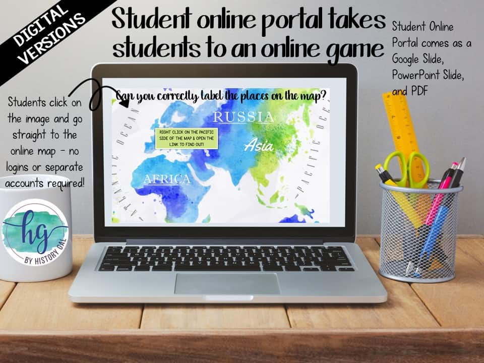
⭐️Online Map lets students test their knowledge of locations in Europe and the Pacific (internet connection is required to access, works on all browsers and with all devices, no account and no logins required, self-checking)
✨This resource is included in the following larger bundles:✨
World War II (World War 2) Bundle
U.S. History from 1877 Map Activities Bundle
U.S. History Map Activities Bundle
U.S. History to 1877 Bundle
U.S. History 1877 to Present Bundle
U.S. History Mega Bundle: Exploration to Present
Questions? Check out the FAQs.
Copyright © History Gal. All rights reserved by author.
Personal classroom use only.


%20Map%20Activity%20&%20Geography%20Activity%20for%20Europe%20&%20the%20Pacific&url=https://byhistorygal.com/product/world-war-ii-world-war-2-map-activity-print-and-digital/&media=https://byhistorygal.com/wp-content/uploads/2021/09/History-Gal_Cover-World-War-II-Map-Activity-1.jpg)
%20Lesson%20Bundle&url=https://byhistorygal.com/product/world-war-ii-lessons-no-prep-bundle/&media=https://byhistorygal.com/wp-content/uploads/2021/09/History-Gal_WWII-Temp-Cover.jpg)
%20Important%20People&url=https://byhistorygal.com/product/world-war-ii-world-war-2-important-people/&media=https://byhistorygal.com/wp-content/uploads/2021/09/History-Gal_Cover-WWII-People.jpg)
&url=https://byhistorygal.com/product/concentration-camps-in-europe-during-ww-ii-map-activity-print-and-digital/&media=https://byhistorygal.com/wp-content/uploads/2021/09/History-Gal_Cover-Concentration-Camps-Map-Activity-3.jpg)
%20Bundle&url=https://byhistorygal.com/product/american-2-bundle/&media=https://byhistorygal.com/wp-content/uploads/2021/05/History-Gal_Cover-US-1877-Present-Bundle-1.jpg)