


Description
These 1914 and 1918 Europe Map worksheets will help students understand the effects of World War I on the European map. They will also help students become more familiar with the nations of Europe during World War 1 by identifying which European countries belonged to the Allies, which ones joined the Central Powers, and which ones remained neutral. Additionally, students will be able to identify the new nations that were created after World War I and which nations lost territory after the war.
What’s Included with the Printed Version:
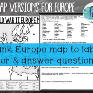
*Blank 1914 Europe map for students to label, color, and with questions for students to answer (2 pages, uneditable pdf)
*Blank 1914 Europe map for students to color and label without questions (1 page, uneditable pdf)
*Coloring Page for 1914 Europe map (1 page, uneditable pdf)
*Answer key for 1914 Europe map and questions (2 pages, uneditable pdf)
*Animated PowerPoint shows each location and the key for the 1914 map – perfect for classrooms without textbooks or Internet access (24 slides, each slide guides students through completing the map, some text is editable but images are not)
*Blank 1918 Europe map for students to label, color, and with questions for students to answer (2 pages, uneditable pdf)
*Blank 1918 Europe for students to label and color but without questions(1 page, uneditable pdf)
*Coloring Page 1918 Europe map (1 page, uneditable pdf)
*Answer key for 1918 map and questions (2 pages, uneditable pdf)
*Animated PowerPoint shows each location and the key – perfect for classrooms without textbooks or Internet access (35 slides, each slide guides students through completing the map, some text is editable but images are not)
What’s included with the Digital Versions:
*Europe Before WWI (1914) and Europe After WWI (1918) for students to label (Slide 1 students will drag labels to the correct spot on the map; Optional Slide 2 includes questions for students to answer; PowerPoint & Google Slides versions; not editable)
*Online Map lets students test their knowledge of locations in Europe (internet connection is required, works on all browsers and with all devices, no account and no logins required, self-checking)
***This resource is included in the following larger bundles:***
* World War I (World War 1) Bundle
* U.S. History from 1877 Map Activities Bundle
* U.S. History Map Activities Bundle
* U.S. History 1877 to Present Bundle
* U.S. History Mega Bundle: Exploration to Present
* Age of Discovery through Modern Times Bundle (World History)
* World History Mega Bundle
Questions? Check out the FAQs.
Copyright © History Gal. All rights reserved by author.
Personal classroom use only.


Reviews
There are no reviews yet.