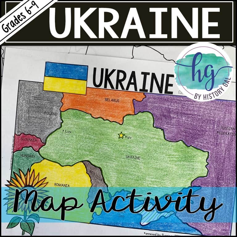
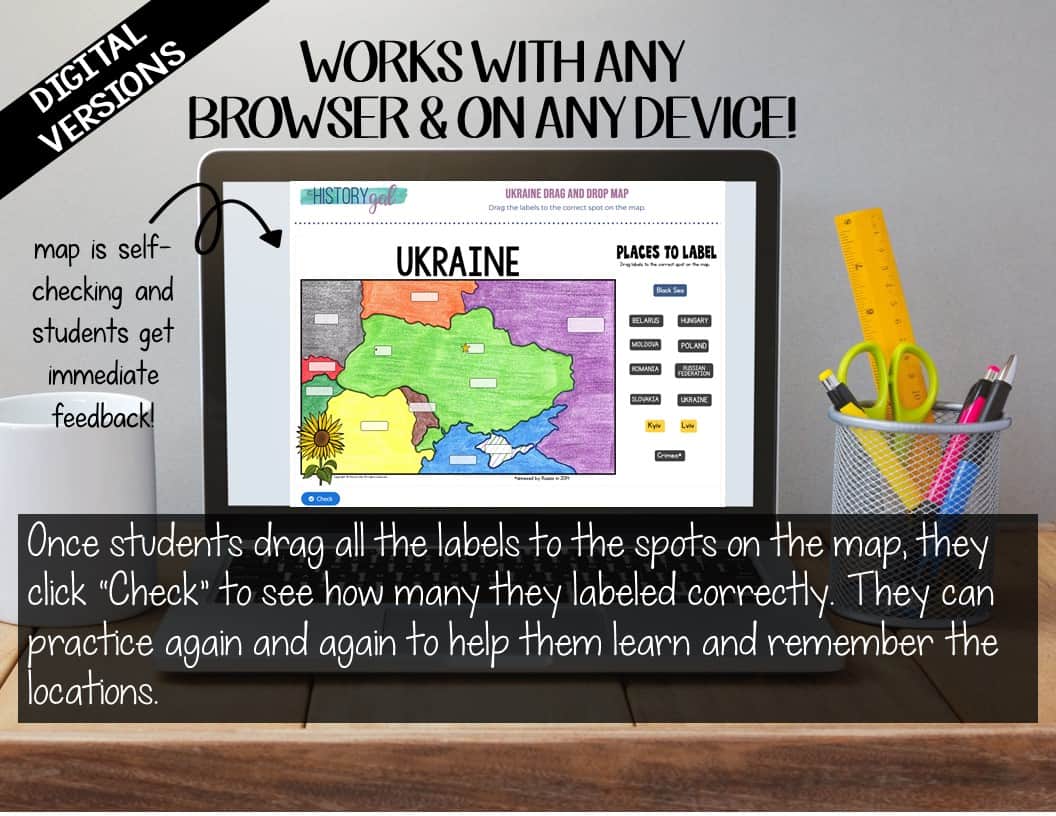
Description
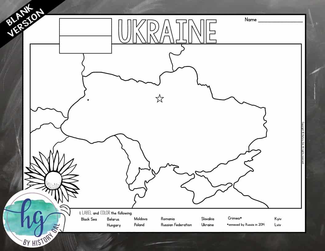
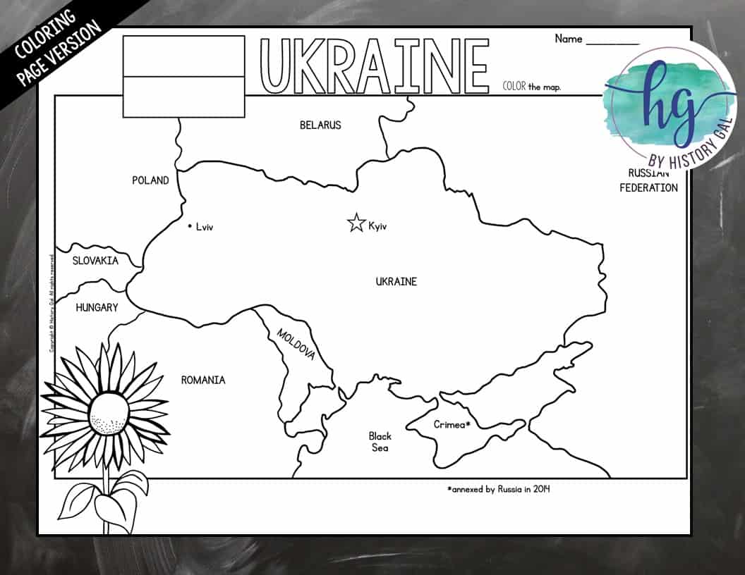
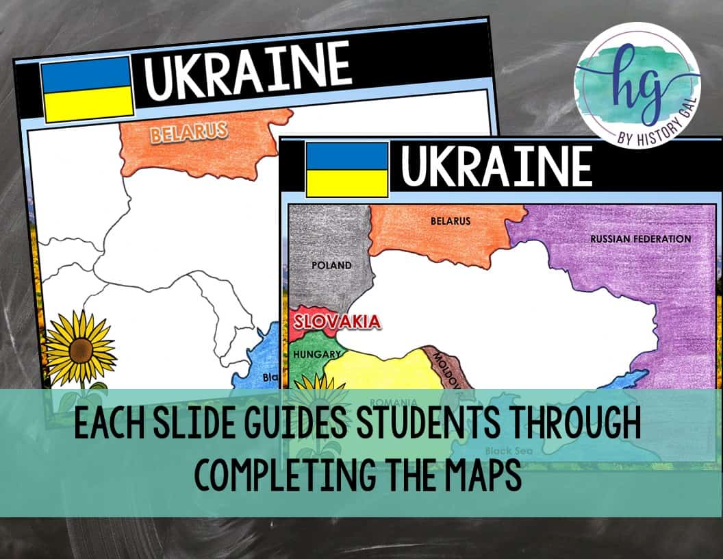
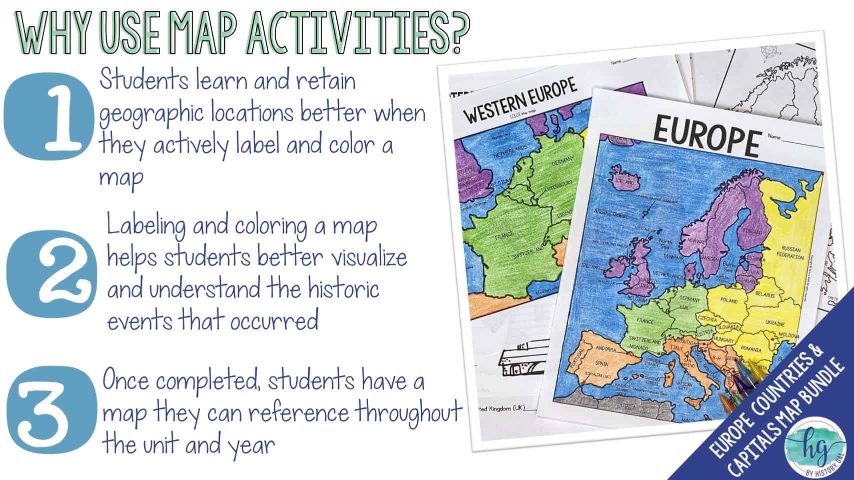
Students will label a map of the Ukraine and the countries that surround it (Belarus, Poland, Slovakia, Hungary, Romania, Moldova, Russian Federation) along with Crimea, the Black Sea, Kyiv and Lviv. This download also includes digital versions so it is easy to use with hybrid classes and remote students.
What’s Included with the Print Versions:
*Blank map for students to label (1 page, uneditable PDF)
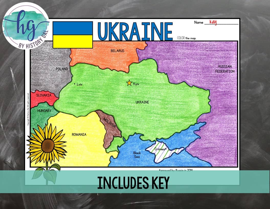
*Labeled map for students to color (1 page, uneditable pdf)
*Answer key for map (1 page, uneditable pdf)
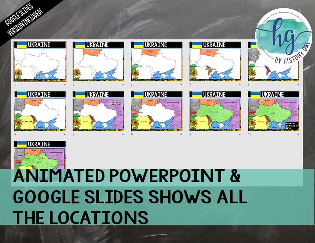
*Animated PowerPoint presentation shows each location – perfect for classrooms without textbooks or Internet access (11 slides, each slide guides students through completing the map, most text is editable but images are not)
What’s included with the Digital Versions:
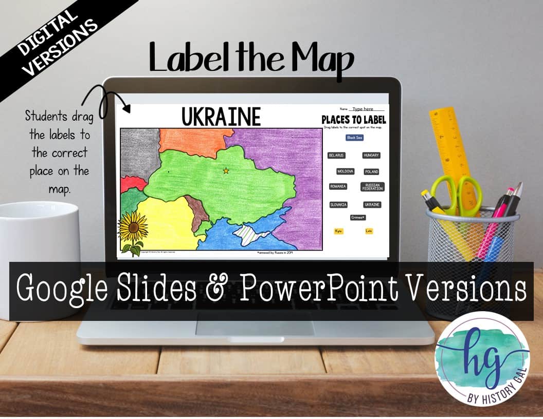
*Blank map for students to label (students will drag labels to the correct spot on the map; PowerPoint & Google Slides versions; not editable)
*Animated Google Slides presentation shows each location (11 slides, each slide guides students through completing the map)
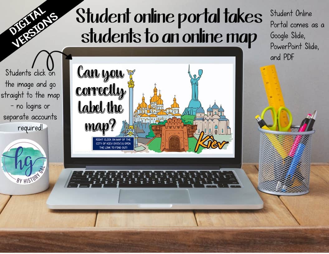
*Online Map lets students test their knowledge of locations (internet connection is required to access, works on all browsers and with all devices, no account and no logins required, self-checking)
Questions? Check out the FAQs.
Copyright © History Gal. All rights reserved by author.
Personal classroom use only.


&url=https://byhistorygal.com/product/cold-war-map-activity-print-and-digital/&media=https://byhistorygal.com/wp-content/uploads/2022/02/History-Gal_Cover-Cold-War-Map-Activity-1.jpg)
&url=https://byhistorygal.com/product/countries-and-capitals-of-the-world-map-activity-bundle-print-and-digital/&media=https://byhistorygal.com/wp-content/uploads/2022/10/History-Gal_Cover-Bundle-Countries-Capitals-4.jpg)
&url=https://byhistorygal.com/product/europe-countries-and-capitals-map-activity-northern-eastern-western-and-southern-europe/&media=https://byhistorygal.com/wp-content/uploads/2022/02/History-Gal_Cover-Europe-Map-Activity-Bundle.jpg)
%20D-Day%20Bingo%20Freebie!&url=https://byhistorygal.com/product/world-war-ii-wwii-d-day-bingo-freebie/&media=https://byhistorygal.com/wp-content/uploads/2020/02/History-Gal_Cover-D-Day-Bingo-1.jpg)
Reviews
There are no reviews yet.