


Description
The 1850 Compromise – do your students need to learn about and understand it? This map activity is an easy to implement lesson that will help your students better understand how the territorial changes to the United States after the Mexican-American War (the Mexican Cession) and the question of slavery in the territories led to the 1850 Compromise.
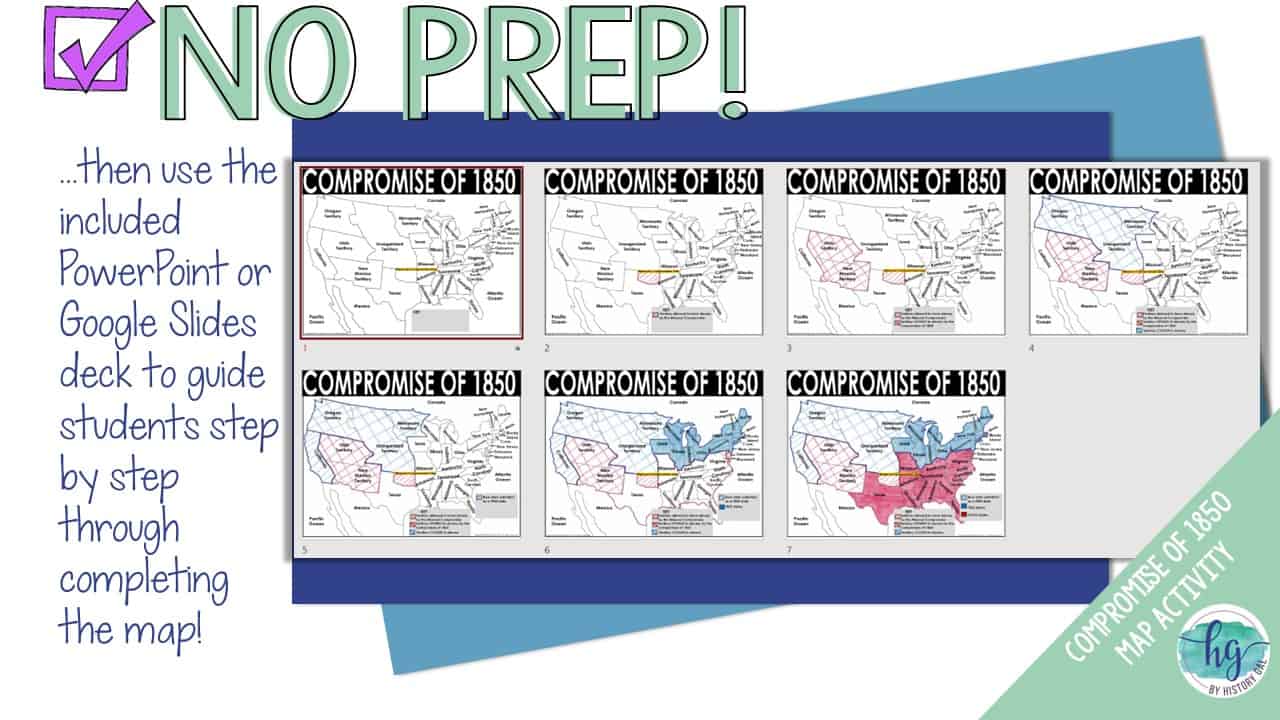
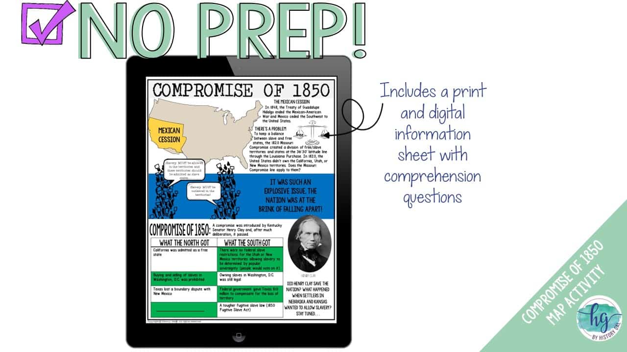
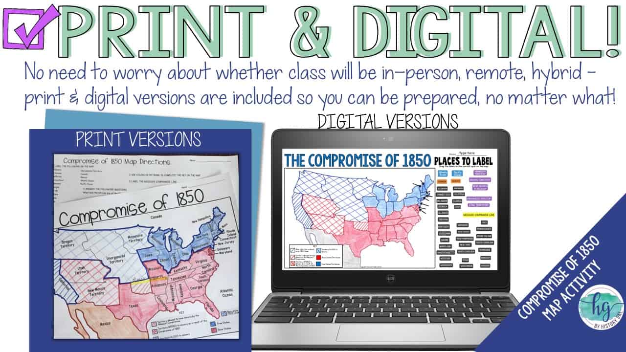
This no-prep print and digital map set makes it easy for your students to create a map they can use while learning about the Compromise of 1850. Students will start by reading a one page passage about the Compromise of 1850 to understand the compromise and its context. Then, students will follow a PowerPoint or Google Slides presentation step by step to label and color a map.
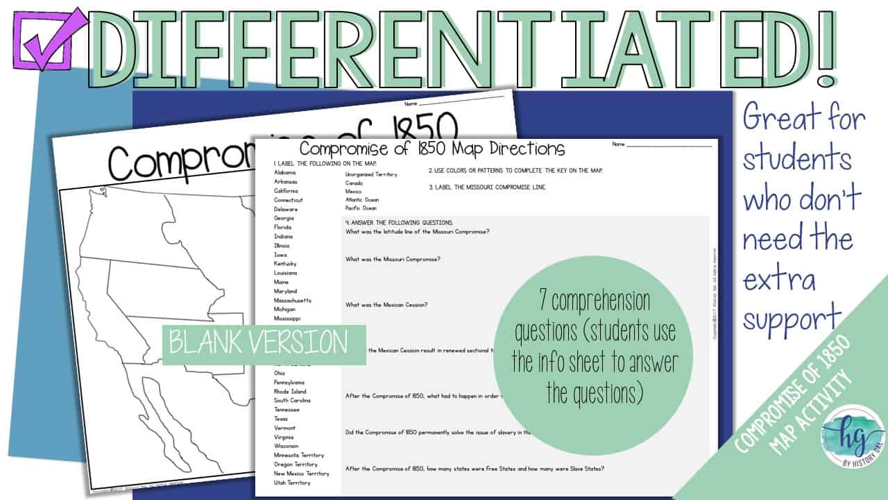
Once students complete their map, they will use their completed map and reading passage to answer seven follow-up questions. Have a paperless classroom or want the flexibility of how to assign the map activity? Students can also label a map by dragging and dropping labels on a digital map.
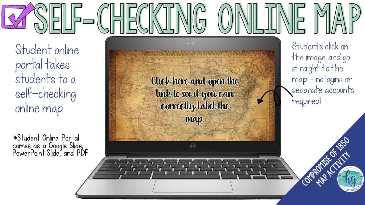
Lastly, students can practice what they’ve learned by using a self-checking online map!
What’s included:
✅ Print & Digital Map Versions (with follow-up questions)
✅ Differentiated Options
✅ PowerPoint & Google Slides Decks
✅ Reading Passage
✅ Link to Self-Checking Online Map
♦️Tip: Have students compare their finished map to a map on the Missouri Compromise. Their Compromise of 1850 Map will also help them better understand the Kansas-Nebraska Act when you cover it a little later ♦️
What’s included with the printed versions:
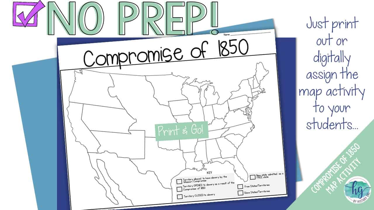
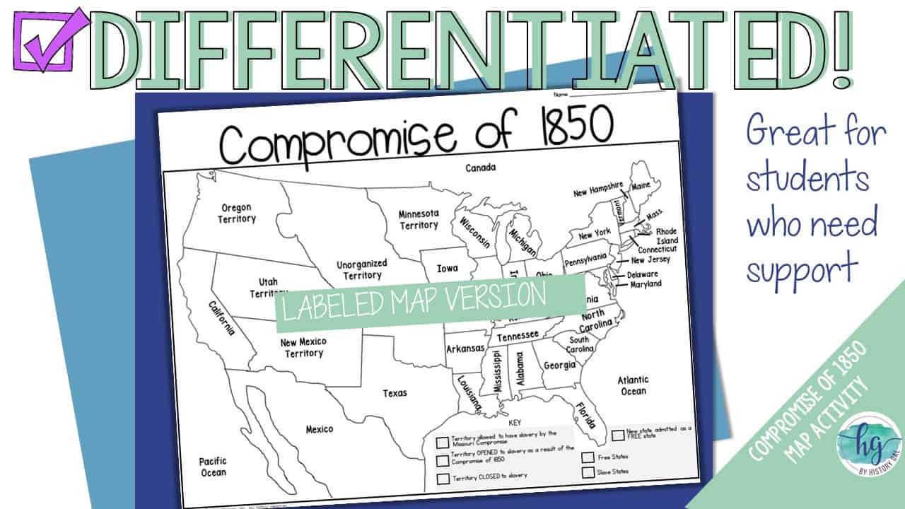
⭐️Blank Compromise of 1850 map for students to label, color, and answer questions (1 page map, 1 page directions; uneditable PDF)
⭐️Map Key (3 pages; uneditable PDF)
⭐️Compromise of 1850 Map Coloring Page (1 page; uneditable PDF)
⭐️Animated PowerPoint shows each location and the key – perfect for classrooms without textbooks or Internet access (7 slides, each slide guides students through completing the map, not editable)
⭐️Informational handout expands on information on the map and can be used to help students answer the map questions if you do not have a textbook or Internet access (1 page, not editable)
What’s included with the Digital Versions:
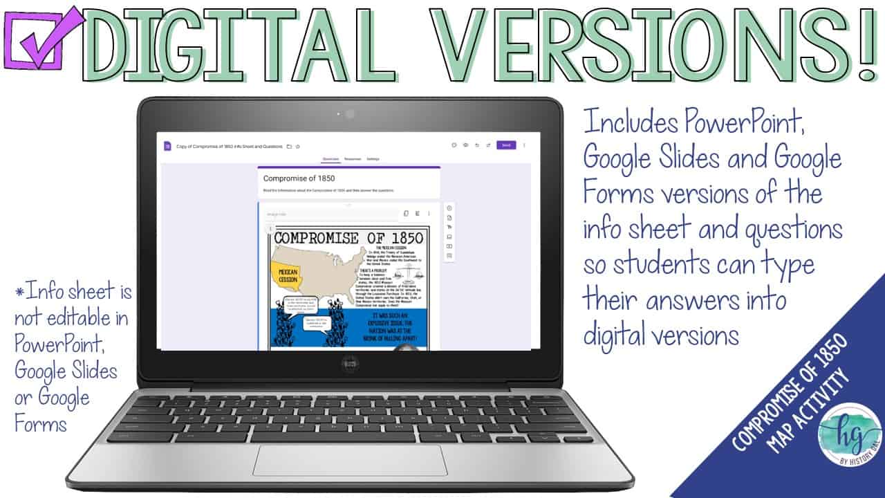
⭐️Compromise of 1850 map for students to label (students will drag labels to the correct spot on the map; PowerPoint & Google Slides versions; not editable)
⭐️Info Sheet and Questions for students to answer (students will type their answers into text boxes; Google Slides, Google Form, and Fillable PDF versions; not editable)
⭐️Online Map lets students test their knowledge of locations (internet connection is required to access, works on all browsers and with all devices, no account and no logins required, self-checking)
✨This resource is included in the following larger bundles:✨
Events Leading to Civil War Bundle
U.S. History to 1877 Map Activities Bundle
U.S. History Map Activities Bundle (Colonization through the Present)
U.S. History to 1877 Bundle
U.S. History Mega Bundle: Exploration to Present
Questions? Check out the FAQs.
Copyright © History Gal. All rights reserved by author.
Personal classroom use only.


%20D-Day%20Bingo%20Freebie!&url=https://byhistorygal.com/product/world-war-ii-wwii-d-day-bingo-freebie/&media=https://byhistorygal.com/wp-content/uploads/2020/02/History-Gal_Cover-D-Day-Bingo-1.jpg)
Reviews
There are no reviews yet.